“Nippletop Mountain…” spoken with the expected inflection. My friend, Tony, prepossessed to ribald humor, is reading off the list of the 46 mountains of the Adirondacks (traditionally) believed to be over 4000 feet, before stopping to emphasize Nippletop. It is mid-May and he and I are returning from Moreau State Park, which we hiked with another friend, Gordon. During the hike, Gordon and Tony got to talking about the 46 High Peaks. Gordon has done many of them, Tony and I have done none. Little do I know but this is a momentous day. While I have a cursory knowledge of the Adirondacks, I know nothing of the challenge which will come to transform me in the ensuing months. My preoccupation with the High Peaks has begun.
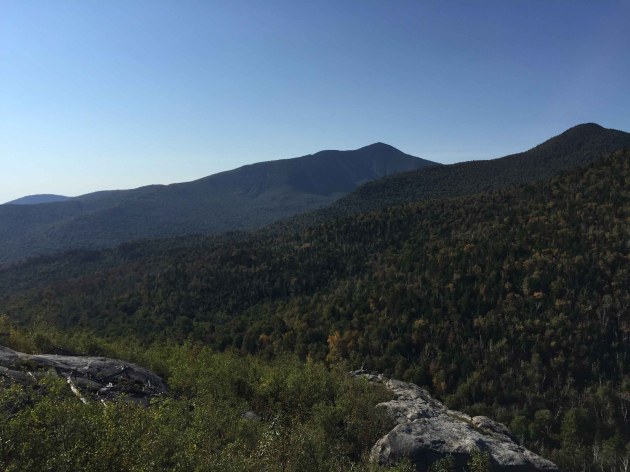
View from the summit of Nippletop Mountain.
I make appeals to the experience of Gordon and hang on his every word. Every hike in the foothills of the Adirondacks is a carefully chosen step towards the final culmination on the top of a High Peak. From the tops of the (comparatively) modest mountains I climb, the High Peaks are far away cloaked in mystery, each rising indiscernibly to the North. There exists a palpable sense of peril behind the hazy mantle of undulations and vertices.
Some two months after doing my first, the day has arrived to tackle the Peak whose name so amused me and Tony months back. By this point, the veil has been lifted off the High Peaks. There is still much to see but the relationship is now intimate — I consider each a friend, even those whose acquaintance I have not yet made.
It is post-Labor Day in the Adirondacks though it feels every bit like Summer, notwithstanding the trails forlorn of tourists. This will be the first hike I do starting from St. Hubert’s, though I have previously soaked in Giant in all its splendor towering beyond the greens of the Ausable Club. (A sight to behold following a hike of Giant, lest its intimidating visage prove overwhelming beforehand). The parking lot for all trails emanating from St. Hubert’s is remarkably close to the Roaring Brook trail parking lot which I erstwhile took to the top of Giant — just across the road (Rte. 73).
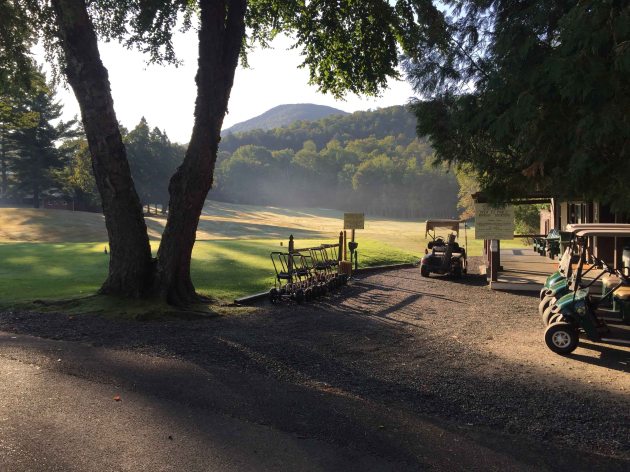
The Ausable Club in the morning. Round Mountain in the background.
In order to get to Lake Road, a private 3.5 mile road from which the trails for many memorable adventures radiate, I must skirt the golf course, tennis courts, as well as historic clubhouse of the Ausable Club. The Ausable Club — or Adirondack Mountain Reserve — owns 7,000 acres of land, a tract of land stretching southwest from St. Hubert’s, encompassing both Lower and Upper Ausable Lakes. The AMR was once in possession of as much as 45,000 acres of land, as well as most of the summits of the “Great Range,” but conveyance (after conveyance) to the state of New York has left the once sweeping breadth of privately owned land greatly attenuated. Nowadays the AMR owns no land higher than 2,500 feet — it goes without saying, if you are atop any of the 46 High Peaks, you are on state land.
At first I resented the AMR. I fancied a bunch of tubby tycoons sitting around burning hundred dollar bills as a sort of membership hazing ritual. While my preconceptions could be true, I’ve begun to recalibrate my views of the AMR. Little did I know but the AMR was sprung from a noble cause in the late 19th century — to preserve the wilderness from intruding lumbering operations. The AMR remains a friend to wildlife as well, as hunting is prohibited anywhere on its grounds. Dogs are verboten as well, their time immemorial association with hunters has blown it for them. So if you think Fido may like wallowing in the Lower Lake, you’re out of luck. If you’ve heard (or recounted) any habituated-to-human deer anecdotes, chances are it occurred on AMR land.
Despite the regulations, the AMR is welcoming to hikers and they’ve done an admirable job maintaining trails and preserving the natural beauty of the land they own — so I tip my hat (or beanie) to them in this regard.
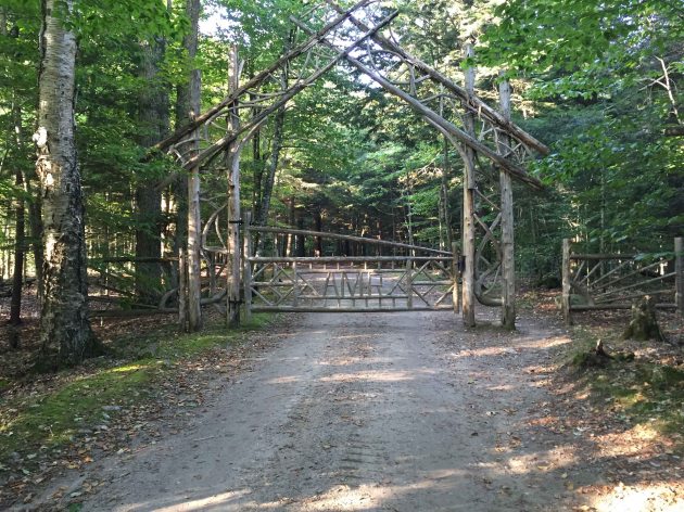
The fancy AMR gate of Lake Road.
Beyond the register, the gate for Lake Road is exquisite and belies how long and uneventful the road is which follows. Nippletop and Dial are regularly completed as a loop. I have cogitated the virtues and drawbacks of doing the hike clockwise and counter-clockwise. The latter being the popular choice and I *surmise* easier trip. However, clockwise appeals to me on two fronts: the views get progressively better climaxing with the Nippletop view and I have the option of forgoing the steep Elk Pass trail down the western side of Nippletop if I so desire.
The turn-off for the Leach trail from Lake Road comes quickly and the trail climbs sharply up the shoulder of Noonmark. I am not prepared for this and fear it is a portent of the day to come. There’s all these stunted trees on the shoulder, prickling up in the wake of a forest fire at one time. This leads to a bunch of ledges offering a great view of the lower Great Range and the rolling trail which ensues. Dix Mountain also looms impressively to the south and could easily be mistaken for Nippletop.
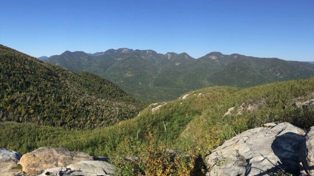
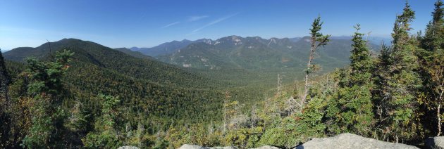
View of The Great Range from the shoulder of Noonmark.
Dix Mountain, center, may at first be mistaken for the end objective, Nippletop. Rather, Nippletop is out of the photo and to the right, beyond Bear Den Mountain, the right most peak pictured.
From there, I descend to the col (a recurring theme) of Noonmark and Bear Den Mountain. Trails like this do little to boost flailing morale, as the fruits of one’s labor quickly dematerialize with an aggressive descent to a col.
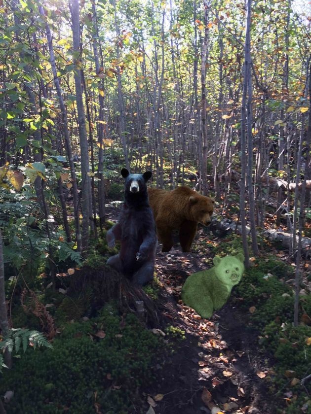
Tread warily on Bear Den Mountain: a black bear, a brown bear, and a Tahawus pygmy green bear (very rare) could strike at any moment. But, it’s all in my mind.
As far as I’m concerned, Bear Den Mountain affords little in the way of views. I tread warily, however, as the specter of (presumably man-eating) bear for which this mountain has been named lingers. I encounter no such bear. It’s a long haul from Bear Den to Dial. As far as I’m concerned, Dial’s summit is not marked. On Bear Den the sign said I was so many miles away from Dial Mountain and on Dial the sign there said I was as many miles away from Bear Den — so I suppose, on deductive reasoning, it is my confirmation of my summiting Dial. The summit of Dial Mountain isn’t much more than a rock from which, upon mounting, there is a good view. The Great Range is shown in all its glory as well as the remainder of the ridge to Nippletop.
The view from Dial Mountain.
Leaving Dial, I descend steeply to a col, this is perhaps the steepest portion of the Leach trail. Alas, the col to which I descend is not shared with Nippletop but another anonymous mountain on the range. The trail gets muddy as Nippletop draws nigh. Thankfully, I have come during a drought, I cannot imagine the trail conditions otherwise, especially around notoriously muddy Elk Pass.
I am keen on seeing the view from Nippletop — given the panegyric heaped upon it. Bob Marshall and James Burnside share the views from two summits inside their top five: Algonquin and Nippletop — the latter appearing higher than the former on both lists, 3 and 4, respectively. To outrank a 5,000+ feet up, 360 degree view, this view from Nippletop must really be a sight to see.
As I draw close to the summit of Nippletop, inaudible chatter permeates through the trees. It cannot be — I have not seen another hiker at all on the trail and no one was signed in before me at the register; surely my recompense should come in the form of summit solitude. I reach the two boulder seats of the “Nippletop summit theatre,” a French Canadian couple recumbent on the left, the lady catching a drag with the affectation of a noir film actress. They have come by way of Elk Pass. I find a cigarette to be a dubious indulgence for the exertion of a hike. But who am I to pass judgement?
Another hiker bursts into the summit area and the couple departs soon after. This hiker, from Massachusetts, has just popped his High Peaks cherry, but he shouldn’t be mistaken for a novice. He is a 48er — having done every mountain above 4,000 feet in the White Mountains of New Hampshire. Nippletop strikes me as an odd introductory Peak. As far as the High Peaks go, it is intermediate in just about every criterion. Well, with the exception of one. The name tends to jump off the list — or, dare I say it, nip out.
“I wanted a view which would give me an idea of where everything is,” the man avows. He goes on to say compared to the Whites, “everything is more concentrated here.” From what I understand, in the Whites there isn’t a mountain, save for perhaps one, from which you could see most of the other peaks. The Adirondacks may be the largest park in the contiguous United States, but the High Peaks are confined to a comparatively small swath of land within it.
Consider the man’s stipulation met on Nippletop. Marcy, central, soars above all others. It resembles a pyramid. So does, the second tallest mountain in New York, Algonquin, off of Marcy’s right flank, though smaller and less conspicuous. The Great Range is full of detail, all of what is generally meaningful is there. Given the wealth of mountain-scape yonder, one may not notice the indistinguishable runt of a mountain in the foreground — It is Colvin. Then (to the left) Blake, the entirety of the range rolls into the haze, whereupon Elk Lake steals one’s gaze.
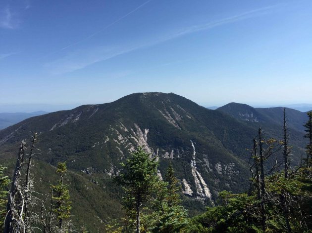
I had to raise my arms into the air above the trees to snap this picture of Dix Mountain (and Hough Peak), as if the trees were a rowdy audience at a rock concert.
Some of my preconceptions of Nippletop were off. For one, I thought the summit was more southern facing, an encompassing view of Dix and its gleaming slides, along with the the rest of the Dix family. Not so. An exceptionable view of Dix is to be had, except it exists behind the trees. There may be a clearing somewhere, but I cannot seem to find one. I also believed there would be a glimpse of one of the Ausable Lakes. I failed to realize Colvin (and its range) stands in the way.
The trail down to Elk Pass has some degree of notoriety for its steepness but it isn’t anything I haven’t seen before. I take my time on the moist ledges. The trail winds around marshy lakes of Elk Pass, before coming to the junction for Colvin. I negotiate a few slabs but the grade of the trail has more or less leveled off. A venerable member of the High Peaks forum to which I belong had suggested I check out Fish Hawk Cliffs and Indian Head. Once arriving at the junction, I estimate it is not much of a digression.
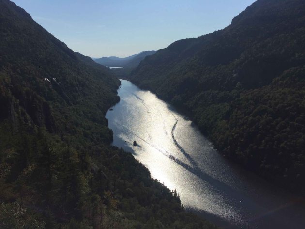
From Fish Hawk Cliffs, Lower Ausable Lake scintillates in the late afternoon Sun.
The view of the Ausable Lakes from Fish Hawk Clifs exceeds superlatives and Indian Head is even better. If you must do just one, Indian Head is all you need. It is the more spectacular of the two, though both have a similar view.The precipice of Indian Head sits at the watershed of Lower Ausable Lake (where it bends to its dam), in the valley of Colvin and Sawteeth, the serrated aspect of the latter (for which it is named) is observable. I look back whence I came — Nippletop. You would think a mountain with a name like Nippletop would be among the most distinguishable of the High Peaks, but that couldn’t be further from the truth. In fact, Nippletop is particularly nebulous as far as the High Peaks go — save for the side it shows Elk Lake. There the nipple is indisputable. Nippletop was, at one point in the 19th century, renamed Dial, since a name like Nippletop didn’t agree with the sensibilities of the locals back then. The story goes Old Mountain Phelps successfully lobbied for it to be changed back.
Breathtaking view from Indian Head.
Bits and pieces of The Great Range can be seen from Indian Head. What of it one can see is interesting. Pyramid and Gothics look colossal, while all of Lower Wolf Jaw can be seen. At the end of the valley is craggy-crested Hurricane Mountain.
There is a ladder and some ladder-steps coming down from Indian Head. I make the long unremarkable walk the length of Lake Road, revisiting in my mind the spectacular sights of the day.


